Application
We cooperate with local developers to provide industrial solutions for customers.
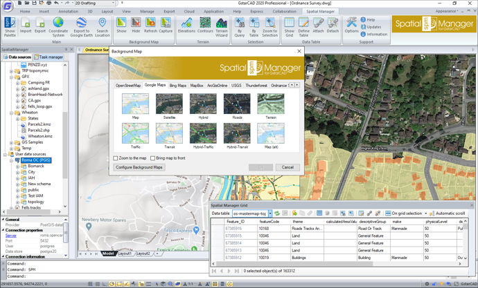
'Spatial Manager for GstarCAD' is a powerful GstarCAD plug-in designed for GstarCAD users who need to import, export, manage and enhance spatial data in a simple, fast and inexpensive way, which includes many possibilities not seen so far in GstarCAD. It comes in a lightweight application that runs inside GstarCAD and, briefly, the following are the features you can find in 'Spatial Manager for GstarCAD':
• Import into GstarCAD from Google Earth (KML or KMZ), OpenStreetMap (OSM or PBF), Shapefiles (SHP), GPS, Points (many formats), Excel, Access, ESRI ArcInfo®, MapInfo, GML (GML or GZ), GeoPackage, PostGIS, SQL Server, SQLite, and many more geospatial sources
• Export from GstarCAD to Google Earth (KML or KMZ), Shapefiles (SHP), GML, Points (many formats), MapInfo, PostGIS, SQL Server, SQLite, and many more geospatial targets
• Transformation of coordinates when needed in any process
• Drawings Coordinate System transformation
• Backgrounds Maps, powerful and easy to use
• Search Locations
• Terrain functions including 3D points from elevation services, DTM meshes, contours, etc.
• Publishing to Google Earth
• Alphanumeric data tables as GstarCAD Extended Entity Data (EED). Manage data tables and fields. Data viewer and editor included
• Save Tasks to replay the import processes so many times as desired
• Interface simple, intuitive and productive
User Guide
http://wiki.spatialmanager.com/index.php/Spatial_Manager%E2%84%A2_for_GstarCAD
Youtube:
https://youtu.be/Oh4fCELK2pI
